Category:Animations of satellite pictures
Jump to navigation
Jump to search
Subcategories
This category has the following 3 subcategories, out of 3 total.
Media in category "Animations of satellite pictures"
The following 200 files are in this category, out of 298 total.
(previous page) (next page)-
 181010 goes16 infrared Hurricane Michael anim.gif 1,282 × 740; 86.12 MB
-
 2020 CIMSS 02S 02s visible infrared map.GIF 800 × 600; 3.4 MB
-
 2020 CIMSS 02S Bongoyo visible infrared map.GIF 800 × 600; 3.5 MB
-
 2020 CIMSS 05B Burevi visible infrared map.GIF 800 × 600; 3.02 MB
-
 2020 CIMSS 05P Yasa visible infrared map.GIF 800 × 600; 3.73 MB
-
 2020 CIMSS 06P Six visible infrared map.GIF 800 × 600; 3.24 MB
-
 2020 CIMSS 06P Zazu visible infrared map.GIF 800 × 600; 3.84 MB
-
 2020 CIMSS 07S Chalane visible infrared map.GIF 800 × 600; 3.03 MB
-
 2020 CIMSS 11W 11w visible infrared map.GIF 800 × 600; 3.84 MB
-
 2020 CIMSS 11W Haishen visible infrared map.GIF 800 × 600; 3.48 MB
-
 2020 CIMSS 14W 14w visible infrared map.GIF 800 × 600; 3.32 MB
-
 2020 CIMSS 14W Dolphin visible infrared map.GIF 800 × 600; 3.24 MB
-
 2020 CIMSS 15E Julio visible infrared map.GIF 800 × 600; 3.3 MB
-
 2020 CIMSS 15L Omar visible infrared map.GIF 800 × 600; 3.22 MB
-
 2020 CIMSS 15W Fifteen visible infrared map.GIF 800 × 600; 3.74 MB
-
 2020 CIMSS 15W Kujira visible infrared map.GIF 800 × 600; 3.06 MB
-
 2020 CIMSS 16W 16w visible infrared map.GIF 800 × 600; 2.97 MB
-
 2020 CIMSS 17E Lowell visible infrared map.GIF 800 × 600; 2.26 MB
-
 2020 CIMSS 17L Paulette visible infrared map.GIF 800 × 600; 2.84 MB
-
 2020 CIMSS 17L Seventeen visible infrared map.GIF 800 × 600; 3.13 MB
-
 2020 CIMSS 18E Eighteen visible infrared map.GIF 800 × 600; 3.66 MB
-
 2020 CIMSS 18E Marie visible infrared map.GIF 800 × 600; 3 MB
-
 2020 CIMSS 18L Eighteen visible infrared map.GIF 800 × 600; 3.34 MB
-
 2020 CIMSS 18L Rene visible infrared map.GIF 800 × 600; 3.09 MB
-
 2020 CIMSS 18W Nangka visible infrared map.GIF 800 × 600; 4.38 MB
-
 2020 CIMSS 19E Norbert visible infrared map.GIF 800 × 600; 2.65 MB
-
 2020 CIMSS 19W 19w visible infrared map.GIF 800 × 600; 3.93 MB
-
 2020 CIMSS 19W Nineteen visible infrared map.GIF 800 × 600; 4.68 MB
-
 2020 CIMSS 19W Saudel visible infrared map.GIF 800 × 600; 4.03 MB
-
 2020 CIMSS 20E Odalys visible infrared map.GIF 800 × 600; 3.51 MB
-
 2020 CIMSS 20E Twenty visible infrared map.GIF 800 × 600; 4.05 MB
-
 2020 CIMSS 20L Teddy visible infrared map.GIF 800 × 600; 3.72 MB
-
 2020 CIMSS 20W 20w visible infrared map.GIF 800 × 600; 3.6 MB
-
 2020 CIMSS 20W Twenty visible infrared map.GIF 800 × 600; 3.58 MB
-
 2020 CIMSS 21E Polo visible infrared map.GIF 800 × 600; 2.59 MB
-
 2020 CIMSS 21E Twenty-one visible infrared map.GIF 800 × 600; 2.88 MB
-
 2020 CIMSS 21W 21w visible infrared map.GIF 800 × 600; 4.12 MB
-
 2020 CIMSS 21W Molave visible infrared map.GIF 800 × 600; 4.07 MB
-
 2020 CIMSS 21W Twentyone visible infrared map.GIF 800 × 600; 3.94 MB
-
 2020 CIMSS 22L Beta visible infrared map.GIF 800 × 600; 3.87 MB
-
 2020 CIMSS 22W 22w visible infrared map.GIF 800 × 600; 3.71 MB
-
 2020 CIMSS 22W Goni visible infrared map.GIF 800 × 600; 3.62 MB
-
 2020 CIMSS 22W Twentytwo visible infrared map.GIF 800 × 600; 2.92 MB
-
 2020 CIMSS 23W 23w visible infrared map.GIF 800 × 600; 4.24 MB
-
 2020 CIMSS 23W Astani visible infrared map.GIF 800 × 600; 3.67 MB
-
 2020 CIMSS 23W Atsani visible infrared map.GIF 800 × 600; 3.92 MB
-
 2020 CIMSS 24W 24w visible infrared map.GIF 800 × 600; 3.37 MB
-
 2020 CIMSS 24W Etau visible infrared map.GIF 800 × 600; 3.73 MB
-
 2020 CIMSS 24W Twentyfour visible infrared map.GIF 800 × 600; 4.06 MB
-
 2020 CIMSS 25W Twentyfive visible infrared map.GIF 800 × 600; 3.78 MB
-
 2020 CIMSS 25W Vamco visible infrared map.GIF 800 × 600; 3.9 MB
-
 2020 CIMSS 26W 26w visible infrared map.GIF 800 × 600; 4.09 MB
-
 2020 CIMSS 26W Krovanh visible infrared map.GIF 800 × 600; 4.11 MB
-
 2020 CIMSS 26W Twentysix visible infrared map.GIF 800 × 600; 4.31 MB
-
 2020 CIMSS 27L Epsilon visible infrared map.GIF 800 × 600; 2.82 MB
-
 2020 CIMSS 27L Twenty-sev visible infrared map.GIF 800 × 600; 2.83 MB
-
 2020 CIMSS 28L Twenty-eig visible infrared map.GIF 800 × 600; 3.77 MB
-
 2020 CIMSS 28L Zeta visible infrared map.GIF 800 × 600; 3.6 MB
-
 2020 CIMSS 29L Eta visible infrared map 0500-1030Z.gif 800 × 600; 3.85 MB
-
 2020 CIMSS 29L Eta visible infrared map.GIF 800 × 600; 3.26 MB
-
 2020 CIMSS 29L Twenty-nin visible infrared map.GIF 800 × 600; 3.72 MB
-
 2020 CIMSS 30L Theta visible infrared map.GIF 800 × 600; 2.3 MB
-
 2020 CIMSS 31L Iota visible infrared map.GIF 800 × 600; 2.97 MB
-
 2020 CIMSS 31L Thirty-one visible infrared map.GIF 800 × 600; 3.76 MB
-
 2020 Creek Fire pyrocumulonimbus cloud formation.gif 624 × 653; 28.96 MB
-
 20203231600-20203240010-GOES16-ABI-MEX-13-1000x1000.gif 1,000 × 1,000; 14.81 MB
-
 2021 CIMSS 08S Danilo visible infrared map.GIF 800 × 600; 3.59 MB
-
 2021 CIMSS 10S Joshua visible infrared map.GIF 800 × 600; 2.76 MB
-
 2021 CIMSS 12S Eloise visible infrared map.GIF 800 × 600; 3.27 MB
-
 2021 CIMSS 13S Thirteen visible infrared map.GIF 800 × 600; 2.77 MB
-
 2021 CIMSS 15P Ana visible infrared map.GIF 800 × 600; 3.86 MB
-
 2021 CIMSS 19S Faraji visible infrared map.GIF 800 × 600; 3.17 MB
-
 2021 CIMSS 19S Nineteen visible infrared map.GIF 800 × 600; 3.49 MB
-
 2021 CIMSS 20P 20p visible infrared map.GIF 800 × 600; 3.91 MB
-
 2021 CIMSS 20P Twenty visible infrared map.GIF 800 × 600; 3.75 MB
-
 20210215000000 texassnow.gif 1,280 × 960; 36.72 MB
-
2022 Hurricane Season (SVS5097 - hurr2022 v6 2160p30).webm 4 min 27 s, 2,160 × 2,160; 107.65 MB
-
2022 Hurricane Season (SVS5097 - hurr2022 v6 4hw 2160p30).webm 4 min 27 s, 3,840 × 2,160; 221.68 MB
-
 210409 ash height anim.gif 1,000 × 821; 19.87 MB
-
 31L 2020-11-13 12-16Z forming.gif 500 × 500; 5.78 MB
-
 A year of space selfies ESA21116504.gif 1,024 × 1,024; 28.13 MB
-
 A-68A iceberg breaks off ESA22399213.gif 1,920 × 1,080; 16.87 MB
-
 A-74 iceberg near collision with Brunt Ice Shelf ESA23433098.gif 1,920 × 1,920; 12.98 MB
-
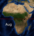 Africa FebAug.gif 1,020 × 1,082; 1.24 MB
-
Africa Mosaic Time-lapse 2019 (50907554683).webm 3.0 s, 1,438 × 1,510; 1.41 MB
-
Africa Vegetation Mosaic Time-lapse 2019 (50908251776).webm 3.0 s, 1,438 × 1,510; 2.45 MB
-
 Amery Iceberg animation.gif 2,000 × 2,000; 4.92 MB
-
 Amphan 1825 190520.gif 640 × 480; 15.18 MB
-
 Amphan 2020.gif 720 × 480; 1.59 MB
-
-
-
-
 Animação do Ciclone Bomba em 1 de julho de 2020.gif 2,152 × 1,837; 39.43 MB
-
 Aprilshowers.gif 720 × 480; 2.82 MB
-
 Arctic Circle oil spill ESA22056844.gif 1,059 × 1,059; 2.01 MB
-
 Ash Cloud Spreads Out From Ruang Volcano on 17-18 April.gif 1,920 × 1,080; 220.69 MB
-
ASTER VNIR 1 black ocean.webm 14 s, 600 × 600; 7.9 MB
-
 Attica floods ESA21479506.gif 2,067 × 1,599; 4.65 MB
-
Australia Vegetation Mosaic Time-lapse 2019 (50929277282).webm 3.0 s, 1,786 × 1,510; 3.06 MB
-
 Avn-animated-Usagi.gif 720 × 480; 3.13 MB
-
 Avn-animated.gif 720 × 480; 3.6 MB
-
 B47 breaks off Getz Ice Shelf ESA21107146.gif 2,000 × 2,000; 14.23 MB
-
 Bavi 2020 landfall.gif 1,050 × 764; 8.37 MB
-
 Bd-animated.gif 720 × 480; 2.71 MB
-
-

-
-
 BennettIslandSatellite.gif 640 × 480; 445 KB
-
 BepiColombo keeping an eye on Earth from afar ESA22011064.gif 989 × 733; 1.17 MB
-
 BepiColombo points to Venus ESA22264108.gif 819 × 819; 8.75 MB
-
 BepiColombo's latest views of Earth ESA21903200.gif 2,048 × 945; 507 KB
-
 BepiColombo’s final glimpses of Earth ESA21944067.gif 1,024 × 1,024; 14.31 MB
-
 BlueMarble monthlies animation.gif 864 × 432; 975 KB
-
 Boucle GOES8-1998-01 07-09.gif 400 × 300; 1.01 MB
-
Breathing planet (50911282191).webm 24 s, 321 × 320; 1.35 MB
-
Breathing planet - vegetation (50911411997).webm 24 s, 321 × 320; 1.58 MB
-
Breathing planet - vegetation with different style (50910593938).webm 24 s, 321 × 320; 1.39 MB
-
Brian Head Fire S2A 432 12118 animation crop 10 small (34811369473).webm 18 s, 1,920 × 1,080; 15.18 MB
-
 Butchoy 2020 Luzon landfall.gif 720 × 480; 1.66 MB
-
Calving and movement of Iceberg A-81 from 22 January to 18 February (52697373746).webm 6.3 s, 1,920 × 1,080; 3.47 MB
-
Calving and movement of Iceberg A-81 from 22 January to 9 February (52680759998).webm 1.3 s, 1,920 × 1,080; 1.53 MB
-
 Carbon monoxide from fires in Australia ESA21788741.gif 2,415 × 2,376; 2.75 MB
-
 Codnexlab.NEXRAD.FWS.N0Q.20140316.306.110ani.gif 700 × 700; 10.47 MB
-
 Comet and 'Churymoon' ESA19661632.gif 1,079 × 990; 12.65 MB
-
 Comet outburst 12 September 2015 ESA19707455.gif 2,048 × 2,048; 5.66 MB
-
 Copernicus Sentinel-1 maps Bangladesh flood ESA24337927.gif 1,920 × 1,920; 18.1 MB
-
 Copernicus Sentinel-2 maps Chernobyl fire.gif 1,755 × 1,273; 4.51 MB
-
 Cyclone Amphan making landfall.gif 640 × 480; 4.77 MB
-
 Cyclone Fani made landfall.gif 720 × 480; 1.65 MB
-
 Cyclone Harold moves through Vanuatu.gif 640 × 480; 8.6 MB
-
 Cyclone Harold rapid intensification.gif 640 × 480; 6.58 MB
-
Daily CO over Togo, Benin and Ghana (49659056437).webm 24 s, 512 × 512; 3.59 MB
-
 Delta 2020 rapid intensification.gif 640 × 480; 16.78 MB
-
 Desastre de Brumadinho.gif 855 × 616; 910 KB
-
-
 Dolphin 2015-05-16 VIS animation.gif 1,280 × 960; 13.18 MB
-
 Dutch tulip fields come into bloom.gif 1,364 × 1,365; 6.5 MB
-
 ECLIPS MSG VIS.GIF 480 × 480; 1.92 MB
-
 Egyptian crop circles ESA19334580.gif 1,920 × 1,080; 96.78 MB
-
 Falcon 9 Flight 77 plume GOES.gif 1,366 × 654; 6.66 MB
-
 Falcon 9 Flight 78 plume GOES.gif 1,366 × 653; 5.91 MB
-
 Frost build-up near Mars north pole.gif 1,464 × 824; 27.93 MB
-
Garzweiler surface mine closing in to Lützerath, NRW, Germany (52629020319).webm 6.4 s, 720 × 720; 7.92 MB
-
 Geocolor.gif 1,000 × 1,000; 32.56 MB
-
 Georges 1998-09-19 2015Z IR.gif 640 × 480; 913 KB
-
 Georges 1998-09-19 2015Z vis.gif 640 × 480; 1.57 MB
-
 Giant iceberg breaks off Brunt Ice Shelf in Antarctica ESA23184247.gif 1,730 × 1,730; 5.32 MB
-
GOES Water Vapor- 1995 Hurricane Season (SVS172).webm 1 min 36 s, 640 × 480; 19.59 MB
-
 GOES-16 RadF true color 2021099 123000 2021099 213000.gif 1,200 × 800; 42.04 MB
-

-
 Goni making landfall on the Philippines on October 31.gif 1,329 × 609; 14.69 MB
-
 Grand Ethiopian Renaissance Dam June to July.gif 182 × 364; 237 KB
-
 Greenland wildfire ESA382357.gif 2,502 × 1,408; 4.3 MB
-
 Hagupit 2020 landfall.gif 800 × 600; 2.92 MB
-
 Haiyan 2013 Floater.gif 720 × 480; 2.71 MB
-
 Haiyan 2013-11-07 0957Z-2330Z.gif 640 × 480; 5.25 MB
-
 Haiyan Mangkhut Landfall Comparison.gif 1,440 × 480; 7.04 MB
-
 Halloween crack ESA21132480.gif 1,920 × 1,080; 6.32 MB
-
Happy Holidays (52578434727).webm 19 s, 1,600 × 1,432; 11.95 MB
-
 Higos 2020 landfall.gif 1,050 × 765; 7.12 MB
-
 HiRISE Spots CO2 Ice Sublimating - PIA23238.gif 1,666 × 1,350; 5.36 MB
-
 Hmw-Taal-2020112-2020113.gif 720 × 480; 9.37 MB
-
 Hurricane Dorian Category 2.gif 600 × 600; 8.65 MB
-
 Hurricane Dorian landfall greyscale.gif 2,320 × 1,254; 26.67 MB
-
 Hurricane Dorian.gif 573 × 455; 7.84 MB
-
 Hurricane Eta nearing peak intensity satellite loop.gif 818 × 789; 14.83 MB
-
 Hurricane Iota at landfall over northeastern Nicaragua.gif 1,000 × 1,000; 27.04 MB
-
 Hurricane Irma.gif 1,500 × 1,000; 6.95 MB
-
 Hurricane Maria .gif 720 × 480; 1.9 MB
-
Hurricane Maria faux 3D animation (36525378893).webm 14 s, 1,920 × 1,080; 20.4 MB
-
 Hurricane Michael making landfall on Florida on October 10, 2018.gif 480 × 480; 44.27 MB
-
 Hurricane Michael on October 10, 2018.gif 640 × 370; 16.03 MB
-
 Hurricane Michael.gif 600 × 450; 2.88 MB
-
 Hurricane Patricia Infrared Animation October 23.gif 720 × 480; 1.24 MB
-
 Ice Loss From Jakobshavn Glacier.gif 720 × 480; 1.68 MB
-
 Ice storm Wv loop.gif 602 × 400; 1.79 MB
-
 Iceberg on the loose ESA25344555.gif 1,920 × 1,080; 5.57 MB
-
 Iota 2020-11-17 440z-1240z.gif 1,000 × 1,000; 22.36 MB
-
 Iran duststorm tmo 2023268 Dusty Skies in Southern Asia.gif 720 × 480; 2.31 MB
-
 Isabel 2003-09-13 1255Z IR.gif 640 × 480; 82 KB
-
 Jangmi 2020 landfall.gif 720 × 480; 4.23 MB
-
 Kammuri 2019-12-02 1830Z to 2019-12-03 0200Z.gif 720 × 480; 4.02 MB
-
 Karl IR loop 21-to-24-09-2016.gif 1,342 × 952; 10.88 MB
-
 Keith 1997 peak IR.gif 880 × 669; 161 KB
-
-
 La Soufriere eruption oblique view.gif 1,284 × 962; 3.77 MB
-
 Lake Mead 2000 2015 comparison.gif 720 × 480; 1.97 MB
-
Lake Urmia time-lapse 2000-2019 (49360854031).webm 4 min 44 s, 512 × 512; 68.13 MB
-
 Lakekariba oli 2019357.gif 720 × 700; 713 KB
-
 Laura 2020-08-27 GOES16-AL132020-GEOCOLOR Loop.gif 1,000 × 1,000; 25.27 MB
-
 Laura intensification and landfall satellite loop.gif 720 × 576; 43.9 MB
-
 Lekima 2013-10-24 MIMIC.gif 720 × 540; 6.91 MB
-
 Lightning Flash Density 12.gif 700 × 460; 1.01 MB
-
 Lightning Flash Density 24.gif 700 × 460; 524 KB
-
 Lonar crater lake color change in June 2020.gif 512 × 512; 1.1 MB
-
 Lonar Lake algae bloom color change in June 2020.gif 512 × 512; 1.93 MB
-
Luxembourg 2018 Drought (49658722526).webm 1.6 s, 512 × 512; 572 KB
-
Madagascar (50875860827).webm 2.0 s, 390 × 720; 331 KB
-
Mamore River Meander (51193485781).webm 9.0 s, 640 × 428; 1.09 MB
-
 Mangkhut Landfall over Luzon 2018-09-14.gif 720 × 480; 2.59 MB


_Static_Fire_Test_conducted_on_14_March_2022.gif)
_Static_Fire_Test_ST01.gif)


